
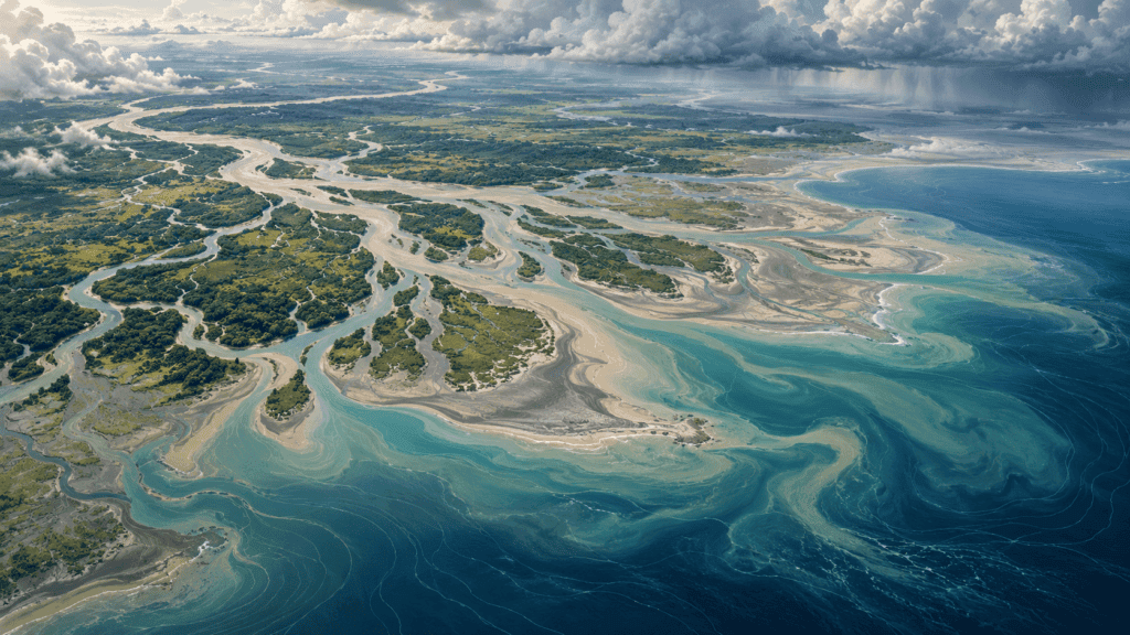
For years, headlines described New Moore as a fickle island: it appeared, vanished, and came back each season, as if it had an appointment with the calendar. The reality is less tidy—and more interesting. South Talpatti, also called New Moore or Purbasha, was a low-lying, uninhabited feature in a shifting delta. In 2010, India’s Ministry of Earth Sciences said it had eroded because of delta dynamics and subsidence, adding that it had not been submerged by sea-level rise. Temporary sandbars in the area do not prove that the same island returns every year.
The story begins with a landscape that has never been still. In the Ganges–Brahmaputra–Meghna Delta, rivers, tides, cyclones, and sediment continually reshape the coast. A map here is not a frozen photograph; it is a hypothesis that must be revisited.
An island born after a cyclone
South Talpatti emerged in the Bay of Bengal after the 1970 Bhola cyclone. Its name depended on who was describing it: New Moore in Indian sources, South Talpatti in Bangladesh, and Purbasha in other accounts. It had no permanent population, buildings, or stable infrastructure.
Its importance did not come from the homes it could hold, but from its position. Where coastlines and territorial waters carry political weight, even a tiny rise above the sea can become a cartographic argument.
The Indian Ministry of Earth Sciences statement adds a crucial qualification: it attributed the erosion to delta dynamics, not sea-level rise. Other 2010 coverage described the island as completely underwater. That difference should not be hidden. The article must distinguish the official statement, news coverage, and available observations instead of pretending every source uses “disappeared” in exactly the same way.
A dispute larger than the island
India and Bangladesh disputed sovereignty over the feature for decades. The issue was not whether to build a city there, but how a small island fit into a complicated maritime boundary.
Once the island no longer emerged permanently, the dispute lost its physical object. Later maritime arbitration delimited sea areas without treating it as stable land. The political story outlived the ground that had prompted it. Resolving the case did not require claiming that one sandbar regularly reappeared; it required applying delimitation rules to the relevant coasts and circumstances.
The arbitral document held by the Permanent Court of Arbitration shows why the case belongs to both geography and international law. A point beneath the water can matter more for what it changes on a map than for what it can support above the surface.
The delta that builds and unbuilds land
A delta works like an erratic factory. Rivers carry sediment, tides redistribute it, and storms can remove in hours material that accumulated over years. Subsidence—the gradual sinking of land—makes the balance more complicated.
Research on coastal changes in the delta shows that the shoreline does not respond to one cause alone. Sediment can build a bar in one place and disappear in another; an island can gain area in one season and lose it later. Subsidence and shifting channels matter, too. “Island” may describe a feature that stays above water for a time, but it does not guarantee identical boundaries every season.
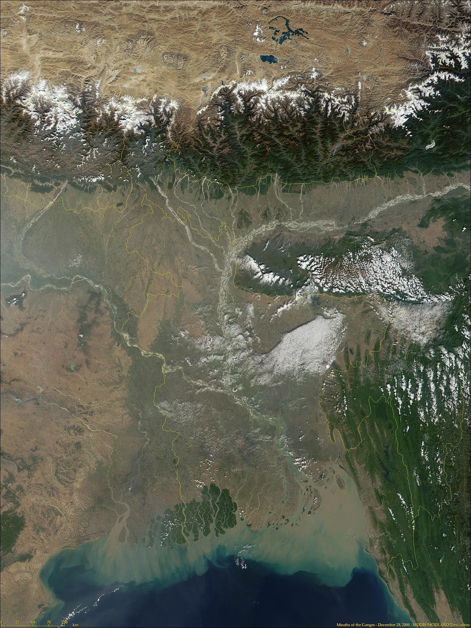
That is why a single satellite image cannot prove an annual return. A reliable comparison needs dates, tides, resolution, sensor position, and a clear definition of “island.” A sandbar visible for a few weeks is not the same as stable emergent land.
The disappearance on record
Around 2010, several news reports said New Moore had stopped emerging. India’s ministry statement, however, described dynamic erosion and subsidence, not a disappearance caused by sea-level rise. That distinction changes the easy headline but improves the story: this was not a controlled experiment that isolated one cause, but a low deltaic feature exposed to several processes.
There is no need to choose one heroic explanation. An island’s evolution in a delta may involve subsidence, erosion, sediment transport, and channel changes; sea level is a regional factor that requires specific evidence before it can be assigned as the cause of one event. A responsible timeline separates observation, interpretation, and cause: “no longer visible above water” is not the same claim as “sank because of global warming.”

The headline trap
“The island that appears and disappears every year” is irresistible because it turns complex geology into a magical calendar. The problem is that it blends different phenomena: New Moore’s disappearance, temporary sandbar formation, and the ordinary variability of a delta.
The World Bank documents the fragility of the Sundarbans system and its surroundings. The region does change, but it does not follow a simple annual choreography. The coast may respond differently after each cyclone and under different sediment conditions.
The headline is not entirely invented; it is a simplification that turns a real story into a repeatable legend. Correcting it means restoring the uncertainty the delta never lost.
A border that was also a question
New Moore is a reminder that maps do more than describe the world: they organize conflicts. A tiny rise can prompt official statements, claims, and legal arguments. When it disappears, the debate it caused does not automatically disappear with it.
A satellite image can help reconstruct this story only when it has a verifiable date, source, resolution, and context. Without those details, it cannot by itself establish when the island stopped emerging or prove a periodic return.
Nor is there enough evidence to draw an arrow labeled “back next year.” The sources reviewed do not establish that the same island reappeared periodically; temporary sandbars in a delta should not be confused with it.
The map after the island
The lesson is not that nature “mocks” geography. It is that physical geography has rhythms that political maps try to fix. A delta does not sign treaties, follow calendars, or preserve a border because a document draws one.
New Moore disappeared as emergent land, but left a cartographic lesson: every image needs a date, every island needs a definition, and every headline should survive a second look. In the Bay of Bengal, the shoreline is not an edge; it is a process.
An island can disappear without returning every season
In a delta, the coast is not a fixed line. Sediment moves, channels shift, and currents erode some areas while depositing material in others. Sandbars and shorelines may appear or change, but that does not prove a specific island resurfaces on an annual schedule. Such a claim would require repeated, comparable observations tied to the same geographic location.
In New Moore’s case, India’s 2010 statement attributed the island’s loss to erosion and delta subsidence. That explanation is less mysterious than the “annual comeback” headline, but more useful: it connects the event to physical processes affecting a broad coastal region. The satellite image of the delta helps explain that setting; it is not a photograph of the island and does not prove that it reappeared.
Caution does not make the story boring. It prevents us from confusing a shifting coastline with an island that magically travels in and out of the map.
Sources for reconstructing the island without the myths
- India’s Ministry of Earth Sciences — official information about the island’s disappearance.
- World Bank: Sundarbans — regional environmental dynamics and vulnerability.
- ScienceDirect: coastal evolution — sediment and shoreline change.
- Indian Council of World Affairs — political and border context.
- Permanent Court of Arbitration — legal documentation on maritime space.